


Story and photos by Chuck Graham
I left the Whitney Portal Trailhead right at midnight, the sheer granite gorge brightening under another starry Eastern Sierra night. Elevation at the trailhead is just under 8,400 feet, and the summit of Mount Whitney — the tallest peak in the Lower 48 — is 14,505. It was going to be a good, long day.
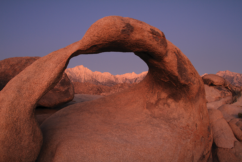
Ascending Mount Whitney in a day is a big day, with just over 6,000 feet of elevation gain. Most hikers and climbers usually take two to three days and camp along the way before reaching its lofty, scenic perch overlooking the gritty Alabama Hills, the stark Owens Valley and the daunting Inyo Mountains to the east.
There are, however, many that choose an out-and-back approach flipping between two routes, the Mount Whitney Trail or accessing the North Fork of Lone Pine Creek. Whatever route is chosen, all peak baggers have their own methods and tricks of the trade to reach the summit of Mount Whitney. However, here are 10 essentials to consider before you sign your name in the ledger at the summit hut.
THE PERMIT PROCESS. You’ll have to enter the lottery for a Mount Whitney permit on www.recreation.gov. The lottery opens in February. In March, lottery winners are notified, and by April those winners must pay for their permit. If you don’t win a permit, don’t despair. There are still two other ways to nail down a permit. People that win a permit but can’t use it will hopefully cancel. For those that want to snatch one of those canceled permits, they can hover online.
There’s also the “No Show” permit. Let’s say you’re in Lone Pine at the Inyo Visitor Center (760.876.6200) off Highway 395, or in Bishop at the Wilderness Permit Office (760.873.2483) and you want a Mount Whitney permit. If someone doesn’t print their permit off of www.recreation.gov by noon, the day before the ascent, you can walk into one of the two locations and obtain a permit. You’ll have to pay for it online, but those at the visitor center and permit office will print a permit that you will carry with you on the day of your ascent.
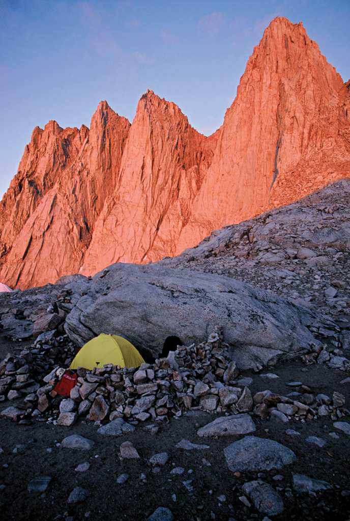
ACCLIMATE. Most folks should be acclimated before their single-day ascent. You can help yourself the day before your permit is active. Hike from the Whitney Portal Trailhead to Lone Pine Lake. It’s 2.8 miles from the trailhead, and the elevation of the shimmering, mirror-like tarn is 9,850 feet. Once there, have lunch, rest and relax. It’s acclimating at its finest.
GEAR DOWN. You don’t need a heavy pack to reach the Mount Whitney summit. Lighter is better, but there are some items needed to complete the ascent in one day. Dress in layers. Essentials include a headlamp, rain gear, sunglasses, sunscreen, hat, two water bottles or a hydration bladder, gloves, trekking poles and an open mind.
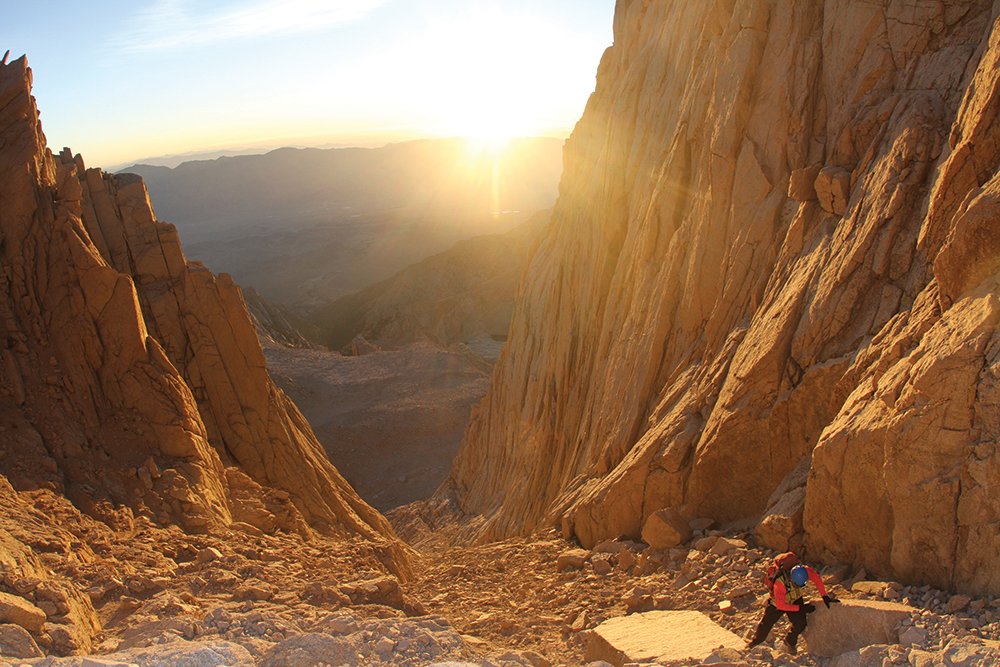
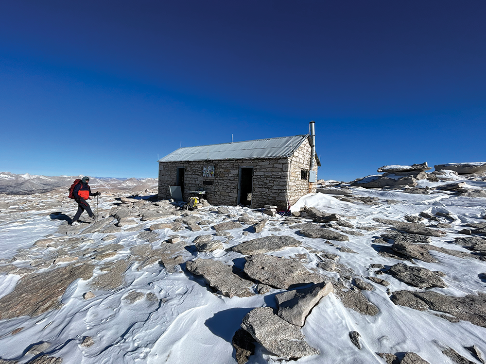
PICK YOUR ROUTE. Most folks head up the Mount Whitney Trail, a well-maintained, 22-mile out-and-back route. The other route is the North Fork of Lone Pine Creek. It’s also known as the Mountaineers Route. It’s half the distance at 11 miles, but it’s physically more demanding than the latter. There’s some route-finding involved, but it’s not nearly as crowded either. The sights are arguably better, too, with a stupendous view of the east face and east buttress of Mount Whitney.
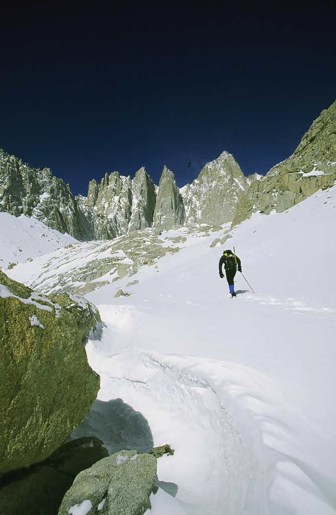
TRAVEL BY NIGHT. Whatever route you take, try to hike in the middle of the night. It’s cooler, and it takes your mind off how far you must go, which forces you to narrow your focus and concentrate on the immediate terrain. And you will be rewarded: There’s nothing like sunrise on the highest peak in California or the whole Lower 48. You’re also less likely to endure monsoonal flow at night. You can expect monsoons throughout the summer, but typically they unleash their fury in the afternoon.
HYDROLOGY. Drink while you go. Just as you should be acclimated, you should hit the trail already hydrated. There’s water along both routes up to about 12,000 feet. There’s plenty of creeks and alpine lakes to gather and filter water. Throughout the day, I drink a bottle of water and rest, then refill and continue upward.
EAT. Being acclimated and hydrated are essential, but you must eat all day. You may not feel like it, but those calories are important to successfully summit. I like dry mangos, dates, burritos, nuts and Probars. I also like gels, Cliff Shots and Honey Stingers to suck on throughout the day. That arid mountain air can dry the mouth out, so I keep popping chews throughout the climb.
MIND THE WEATHER. I recommend watching the weather a week out before your Mount Whitney ascent. I rely on the Windy app, www.windy.com. It covers wind, clouds, snow, rain, fog, etc.
MIND THE CRITTERS. Mount Whitney is part of the Inyo National Forest, and wildlife is abundant. From black bears to golden-mantled squirrels, it’s our responsibility to keep wilderness areas cleaner than how we find them. So, pack in and pack out. Marmots might pose the biggest threats above treeline. I once saw a backpacker filtering water near the trail crest on the Mount Whitney Trail. He had placed his pack just off trail, and as he filtered water, a marmot seized the opportunity and began tugging his pack into a deep hole in the granite. Don’t turn your back on your pack. You might not see it again.
THE DESCENT. Reaching the summit is only half the battle. There’s a relief and a euphoria while standing on any summit, but descending can be just as challenging. Fatigue is a factor, and just because you reached the summit, it doesn’t mean you don’t need any more calories, or you don’t need to hydrate any longer. All those things need to continue until you’ve returned to the trailhead.
Mount Whitney Information:
www.fs.usda.gov/recarea/inyo/recreation/hiking/recarea/?recid=20806&actid=51
www.nps.gov/seki/planyourvisit/whitney.htm
Mount Whitney Ranger Station
640 South Main Street, Lone Pine
760.876.6200
Inyo National Forest
EASTERN SIERRA VISITOR CENTER
US-395 and CA-136, Lone Pine
760.876.6200
Inyo National Forest
WILDERNESS PERMIT OFFICE
351 Pacu Lane, Suite 200, Bishop
760.873.2483
Reservations:
www.recreation.gov


